Optimizing Subsurface Infrastucture Cross-Sectional Profiles
Léon olde Scholtenhuis
Organisation || Gemeente Amsterdam
Candidate Eng || Aleksandra Bratic
Start - end || September 2025 - August 2027
As cities grow, the demand for the underground space intensifies, making the coordination of different assets more complex than ever. The city of Amsterdam is no exception. In addition to accommodating the growing population’s need for water and electricity, the subsurface is an integral part of supporting larger initiatives, such as the Energy Transition and the Greener Infrastructure Vision. Looking at just the energy transition, Gemeente Amsterdam aims to be natural gas free by 2040. With 85% of the homes in Amsterdam using natural gas for heat major change to the subsurface infrastructure. Some network operators estimate that 50% of streets needs to be opened and redesigned to accommodate the energy transition.
Traditional subsurface design methods are bogged down by the additional complexity and take more time to coordinate between the different asset owners. The mandatory excavation reporting tool managed by the Dutch Land Register, KLIC, only keeps record of the different assets in latitude and longitude, giving no understanding of depth. With so many different assets fighting for space now, vertical synergy is a need to have, not a nice to have. Furthermore, some parts of Amsterdam need a full redesign. Changes that need to be made are more than the addition of new cables and pipes but a redesign of the road overall to add new functionality.
The increasing strain on underground infrastructure in urban environments presents both a critical challenge and an opportunity for innovative solutions. In this research, parametric functions and generative modeling will be combined based upon official rules and (few existing) accepted spatial planning norms to design subsurfaces.
The goal is to demonstrate the possibilities of assisting designers using computer generated designed. When implemented as a tool, this method would minimizes manual effort while expanding creative possibilities for combining different assets in the underground to save space.
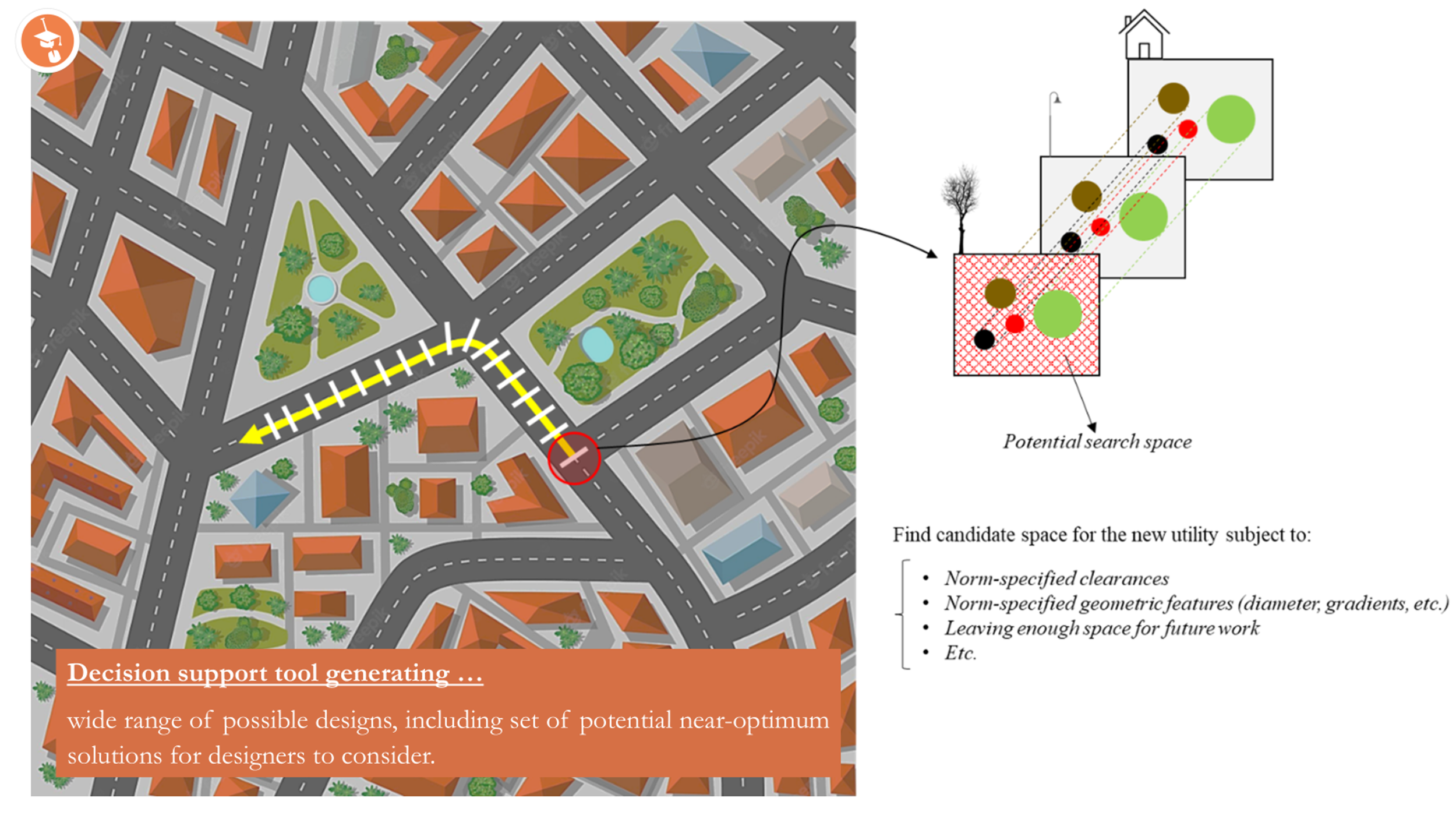
Visual representation of envisions design approach for subsurface infrastructure
First, a thorough investigation needs to be conducted to understand if the official rules and regulations accurately represent viable distances of assets placed in the subsurface. Based on of the validated rule and regulations, a parametric model will developed to more accurately represent the assets in the ground. We envision the end product to divide subsurface space as “Swiss cheese slices” where each slice represents a local cross sectional layout of pipes, cables, tree roots and other assets. A generative algorithm will produced to offer viable options for the assets, based on the previously confirmed constraints. These are the initial step of the research and are subject to change through the process.