Semi-automatic records deviation characterisation and quantification
Léon olde Scholtenhuis
Organisation || Aalborg University (AAU) & University of Twente (UT)
Candidate || Rens Bos
Type of project || MSc thesis
Period || Feb 2026 – Aug 2026
National utilities location registries, such as the Dutch KLIC, Belgian KLIP and Danish LER, hold information about buried cables and pipelines. However, much of their legacy data is still two-dimensional and lacks a reliable depth value. Some of the data is outdated and may no longer accurately represent the current as-is situation. The gap between what is registered and what is actually in the ground leads to thousands of utility strikes each year, with high safety and (socio-)economic costs.
Every open trench (e.g. trial trench) briefly exposes utilities and offers a low-cost opportunity to capture as-is data and correct the records. So far, however, there has been no automated way to detect and measure how far the records deviate in depth from the real situation.
This MSc thesis develops a semi-automatic Python pipeline that compares statutory utility records against as-is open-trench point clouds from the Danish OpenTrench3D dataset. The aim is to support the reconciliation step of upgrading old 2D records to 3D. The preliminary work delivers a set of interactive viewers. They align the two heterogeneous datasets in one common digital model, separate the point cloud into individual utilities, and give a plausible depth to records that have no registered z-coordinate.
A deviation characterisation module then compares each observed utility against its matching record and shows the deviation between the records and the observation as a colour-coded heatmap based on legal accuracy classes (from LER).

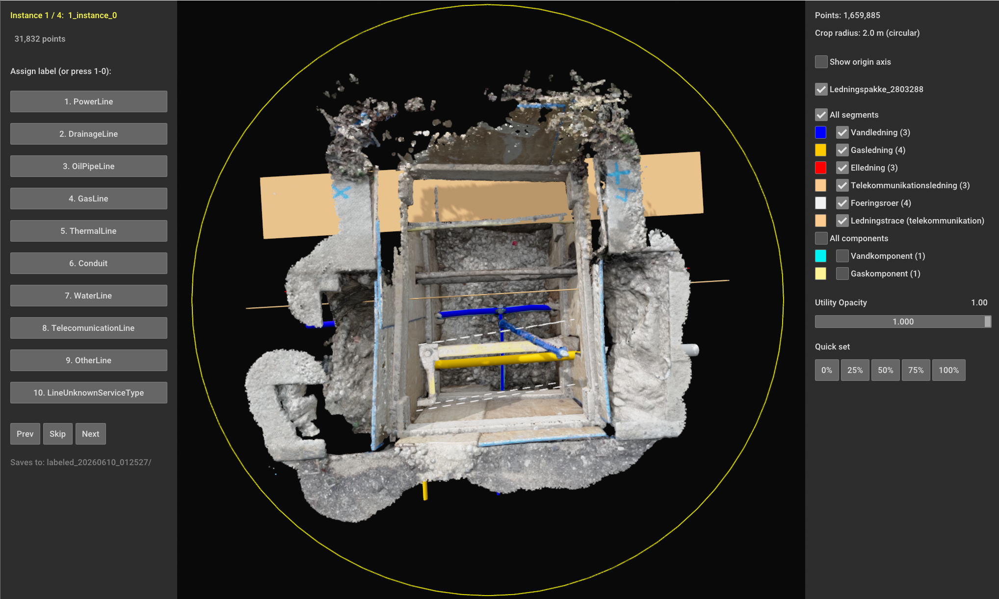
Input screen of deviation detector pipeline: labeling automatically segmented lines. This screen inputs into a deviation quantification function within the pipeline.
As a result, the deviations become explicit, thereby supporting the upgrading of existing 2D registrations to 3D. Although the Dutch WIBON policy evaluation[1] claimed in 2023 that a retrospective enrichment of historical records difficult or unrealistic to achieve, this study provides preliminary evidence that for utilities exposed during excavation, it is technically feasible to improve the registration of legacy data.
The remaining question is therefore not technical but a matter of policy and responsibility: if the data can be captured and corrected during work that happens anyway, who should be tasked with doing so? Until that is decided, society keeps paying for the cost of inaccurate statutory records.
[1] https://www.rijksoverheid.nl/documenten/2023/10/31/beleidsevaluatie-wibon-kwink-groep